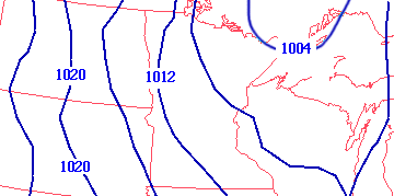
Isobars are contour lines on a map that meteorologists use to predict the weather. These lines connect points of equal atmospheric pressure at a given time or on average over a given period. The isobar map located above shows pressure levels west of the Great Lakes.
No comments:
Post a Comment