http://www-personal.umich.edu/~mejn/cartograms/
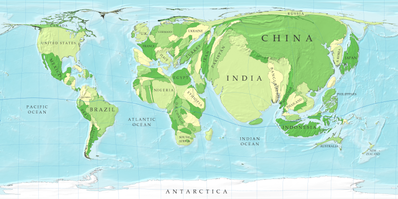
A cartogram is sometimes referred to as a "value-by-area" map. Cartograms take regular maps and depending on what the cartogram is measuring, will alter the geography proportionally to the data. This is probably the most famous cartogram as it shows the countires of the world drawn to scale in terms of population. As you can see, India and China have grown substantially whereas a country like Canada is minimized.
No comments:
Post a Comment