http://mappa.mundi.net/maps/maps_014/
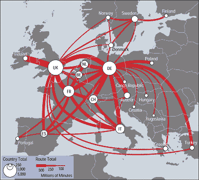
Flow maps are used to show the movement of objects from one location to another. Data generally shown in flow maps includes: immigration, trading of goods, and travel routes. This map illustrates traffic flows between European countries in terms of red lines. The thicker the red line the more millions of people traveling that traffic flow. For example, UK to Norway is seldom traveled in comparison with UK to Ireland.
No comments:
Post a Comment